
Otley is a town steeped in history, so much so that people have lived in these parts since prehistoric times. Follow this trail to find out more about the town’s fascinating history.
PDF download of this trail – click here
Google Earth version – click here
See this trail on Google Maps below
Neolithic rock art found on Otley Chevin tells us that people have passed through the surrounding area since prehistoric times, but it is thought that Otley’s origins as a settlement date back to the Saxon era.
During this time, Otley was part of a large manor stretching from Timble to Baildon which was overseen by the Archbishops of York, who had a residence in the town.
Henry III granted a market charter in the 1220s and other industries such as linen and cloth weaving were developed later.
Stone quarried from Otley Chevin was used to build the Houses of Parliament in London, while the 1850s’ invention of the Wharfedale Press in Otley revolutionised the printing industry.
Today Otley is a modern market town, but much of its history can be seen on this simple guided walk.
About this walk
Length: 0.7 miles (1km), without the extensions to the Chevin and Farnley, which make the total route three miles (5km) long
Time taken: 30 minutes (brisk) to 90 minutes (slow)
Difficulty: Medium
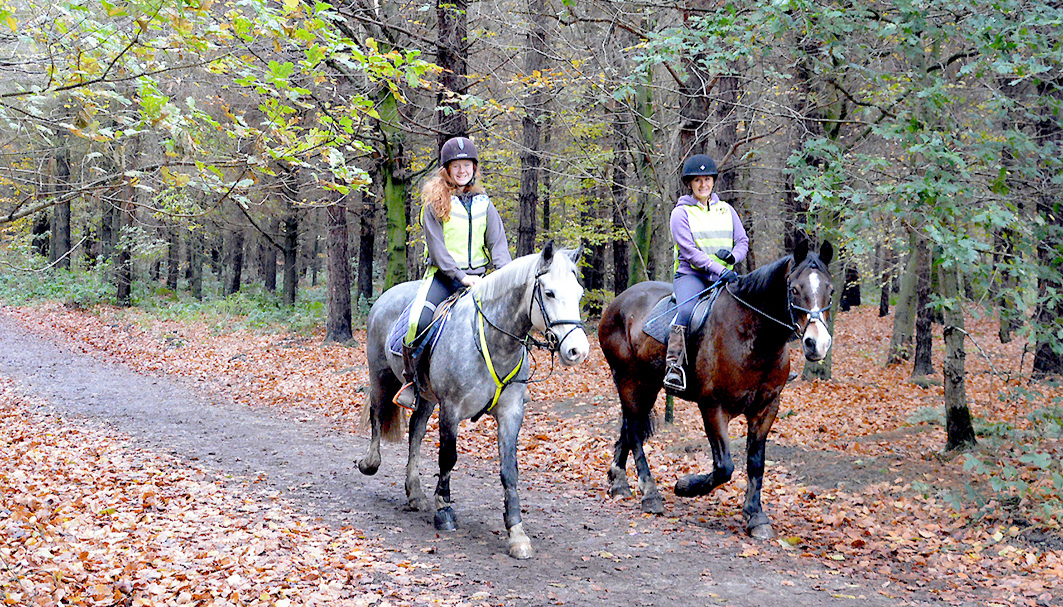
1 Otley Chevin and the Knotties Stone
The Wharfe Valley was carved by the advance and retreat of Ice Age glaciers some 20,000 years ago – and evidence of these can be seen in the town today as All Saints Parish Church stands on the end of a moraine.
The Chevin takes its name from the Cambric word cefyn, which means a sharp ridge. It is a large millstone grit escarpment that defines and protects the town.
The remains of a Roman road still exist in the fields behind The Royalty pub on York Gate near Surprise View, the Chevin’s highest point.
Close to Surprise View, visitors can find the Knotties Stone, which carries a Neolithic cup-and-ring design dating from the Bronze Age. The stone is part of a series that runs from Otley Chevin to Rombald’s Moor in Ilkley. It is said to be one of the highest concentrations of Neolithic rock art in Europe.

2 All Saints Parish Church
The site of All Saints Parish Church may have been consecrated as early as the 2nd century AD when Christianity first came to Britain.
Three Anglian crosses, the oldest dating from around 750AD, have been found here and these may have have been used as focal points for Christian gatherings before the church was erected. The foundations of the current church are thought to be Anglo-Saxon in origin, but the main body dates from 11th-century Norman times. Significant additions were made in the 13th, 15th and 19th centuries.
The church houses memorials to the Fawkes and Lindley/Palmes families, as well as a tomb in memory of members of the Fairfax family that played a significant role in the English Civil War. It is also home to a First World War Memorial made of the finest Carrara marble from Italy.
3 Navvies Memorial
In the 19th century the railway came to Otley with its own branch line. The 1845–49 building of the Bramhope Tunnel to accommodate the Leeds & Thirsk Railway brought thousands of labourers called navigators or ‘navvies’.
There was much pressure to construct the line in a timely fashion and some 2,000 people were employed to help, living in a temporary shanty town on the site.
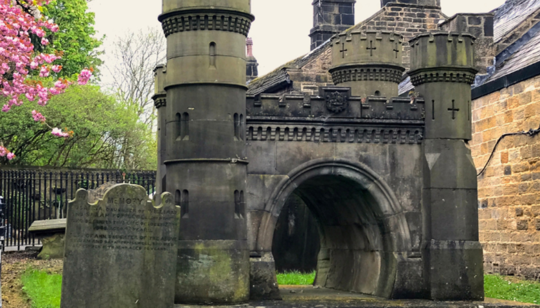
This memorial, a replica of the tunnel, stands as a record to those who lost their lives working on the project. It is a Grade-II listed building.
4 Jubilee Clock
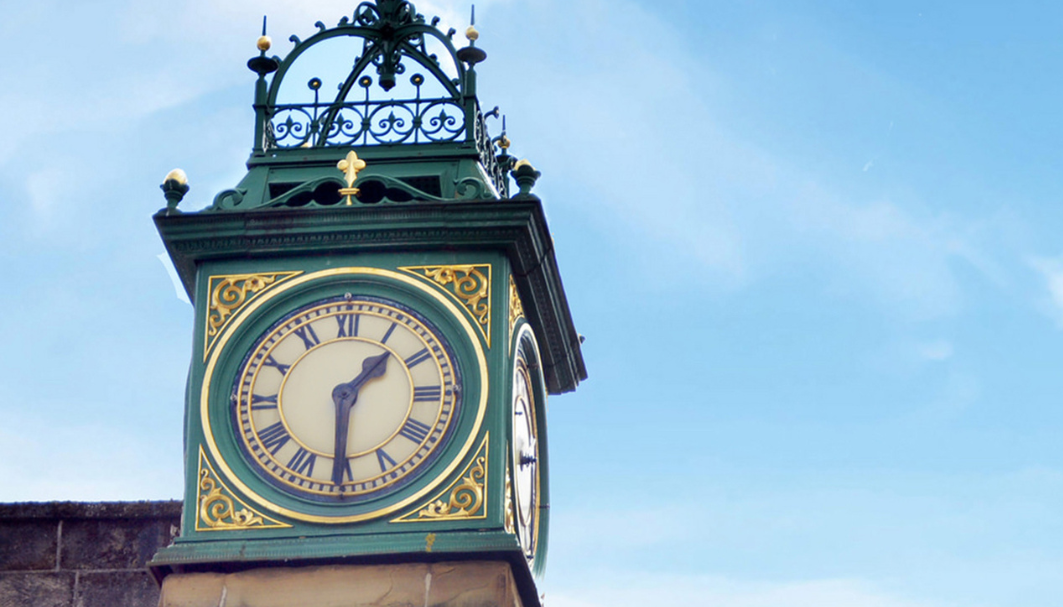
Built in 1887 to celebrate the Golden Jubilee of Queen Victoria’s reign, the Jubilee Clock Tower is perhaps the most iconic image of Otley and also serves as the notional town centre. It is thought to be built on the site of the original Market Cross.
It has several plaques added to it, including one on behalf of Belgian refugees who thanked the people of Otley for their hospitality during World War I.
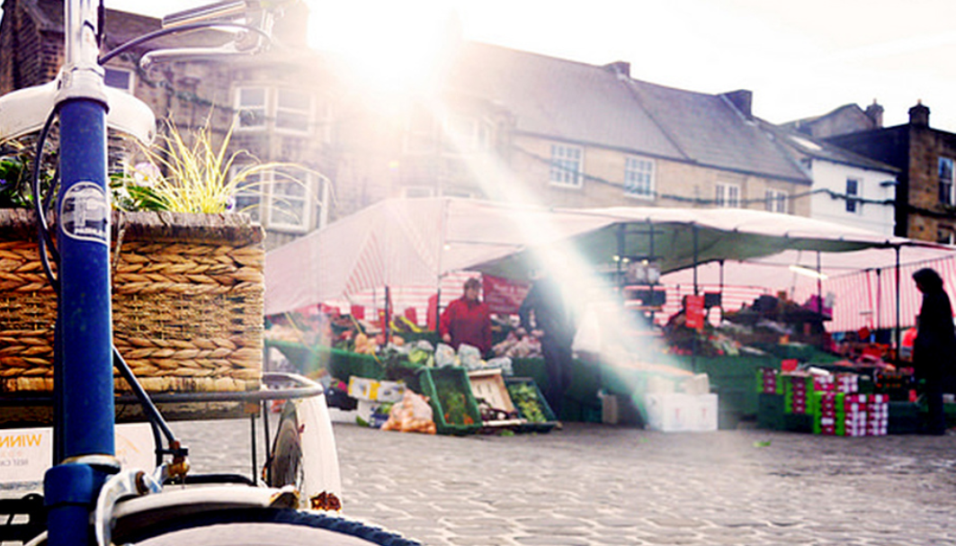
5 Otley Market Place
Markets have been held in Otley since the mid 1220s and there are still thrice-weekly markets and a bi-monthly farmers’ market held in Market Place.
The market is also home to the Black Bull pub, which is where, legend has it, Sir Thomas Fairfax’s parliamentary soldiers gathered on the eve of the Battle of Marston Moor which took place on July 2, 1644.
The troops are said to have drank the town dry before going on to defeat the Royalist army in one of the most significant battles of the First English Civil War (1642–1646). Otley and the Market Place also double as the fictional market town of Hotten in the ITV series Emmerdale.
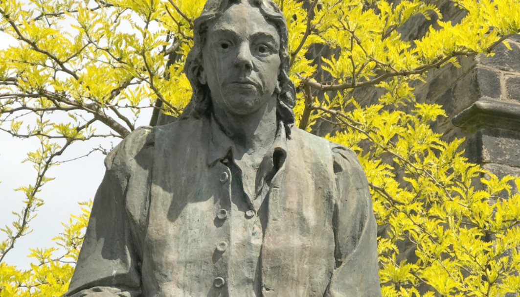
6 Thomas Chippendale Statue
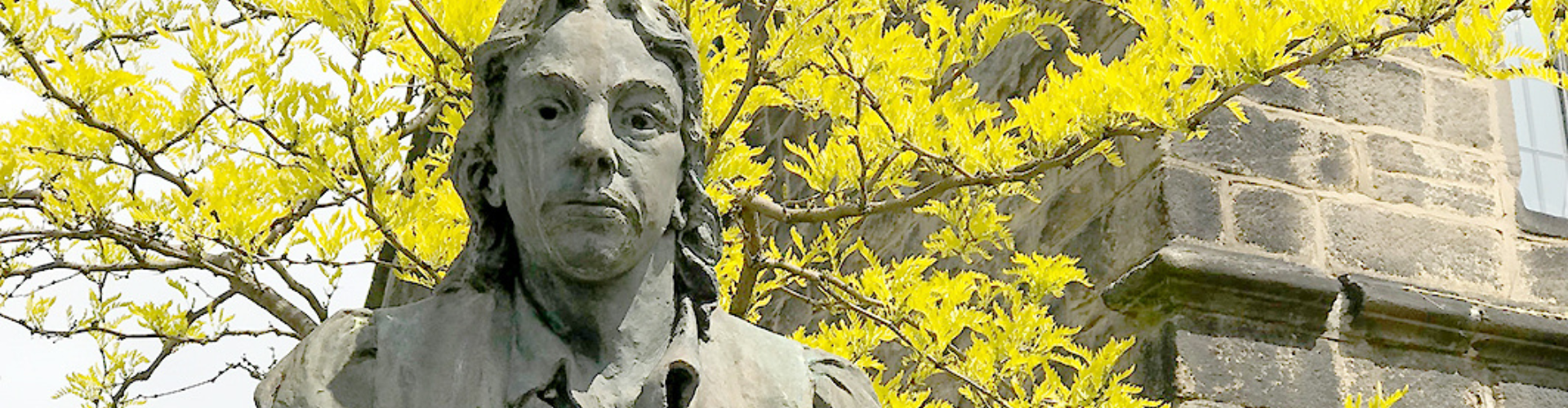
Famed cabinetmaker Thomas Chippendale was born in Otley in the summer of 1718 and baptised in the Parish Church on June 5 of the same year.
While some of the facts about his early life are hazy, it is thought he may have attended a school on the site of the Old Grammar School on Manor Square.
The site is home to a statue and blue plaque in his honour.

7 Otley Courthouse Project
With the advent of the Industrial Revolution, a woollen industry emerged in Otley as the town began to thrive. To facilitate Otley’s expansion, the Courthouse was built and the building also housed a police and fire station.
Today a much-loved arts centre that features performances from national names such as Britain’s Got Talent star Daliso Chaponda (above), one of the original cells has remained in its former condition and can be viewed on tours of the building. This venue has also doubled as the police station in old-favourite ITV series Heartbeat.

8 Otley Bridge
Otley Bridge (a Scheduled Monument) over the River Wharfe provides a focal point for the riverside area and links the two halves of the town, historic Otley and Newall, formerly a separate township.
The western side of the bridge is thought to date from around 1228, when the Archbishop of York, titular Lord of the Manor of Otley, had it built to provide a more direct route to York.
It was substantially rebuilt in 1673 and 1776, and had a cantilevered pedestrian walkway added to the eastern side in 1957 and replaced in 2025.
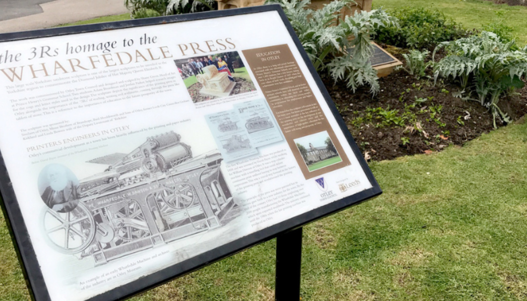
9 3Rs Wharfedale Press
The Wharfedale printing press, developed by David Payne in Otley in the 1850s, revolutionised the printing industry making continuous sheet printing available for the very first time. At the time, it was the single greatest leap in printing technology since the printing of the Gutenberg Bible in the 15th century.
A number of buildings from the golden era of printing remain, some of which are marked with brown plaques. By 1911 more than 2,000 people were employed at various foundries in the town, manufacturing these presses which were exported worldwide. This carved monument remembers Otley’s printing history.

10 Farnley Hall
North-east of Otley lies Farnley Hall, an imposing 16th-century manor house owned by the Horton-Fawkes family. It was built in Elizabethan times by the Danby family, but an older house on the site is recorded in the 1086 Domesday Book as Fernelei.
In the early 19th century, a regular guest was Romanticist painter JMW Turner who used the dramatic landscapes around Wharfedale as a backdrop to one of his most famous paintings, Snow Storm: Hannibal and his Army Crossing the Alps.
The house still has one of the finest private collections of Turner paintings in the country. Tours are available for pre-arranged groups only. See farnleyhall.co.uk